International Education Statistics

Analysis by Friedrich Huebler

30 June 2009

Updated "Guide to creating maps with Stata"

The guide to creating maps with Stata has been updated with new links to third-party software.

Map created with spmap in Stata: length of country names
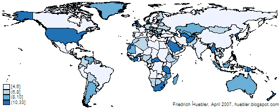
Example map created with spmap in Stata

Related articles
  • Guide to creating maps with Stata
  • Guide to integrating Stata and external text editors
  • Guide to creating PNG images with Stata
  • Guide to reading Statalist with Gmail

Friedrich Huebler, 30 June 2009, Creative Commons License
Permanent URL: http://huebler.blogspot.com/2009/06/stata-maps.html
Friedrich Huebler on Tuesday, June 30, 2009 No comments:
Share
‹
›
Home
View web version
Powered by Blogger.